When a layer is selected, its parent (container) group is highlighted (via the blue bar to the left) to make it easier to locate within long lists.

We have added more line-dash options such as a large dash and dotted line. These styles can also be attribute driven, helping to visually differentiate different line types. Colours can still be used as well.
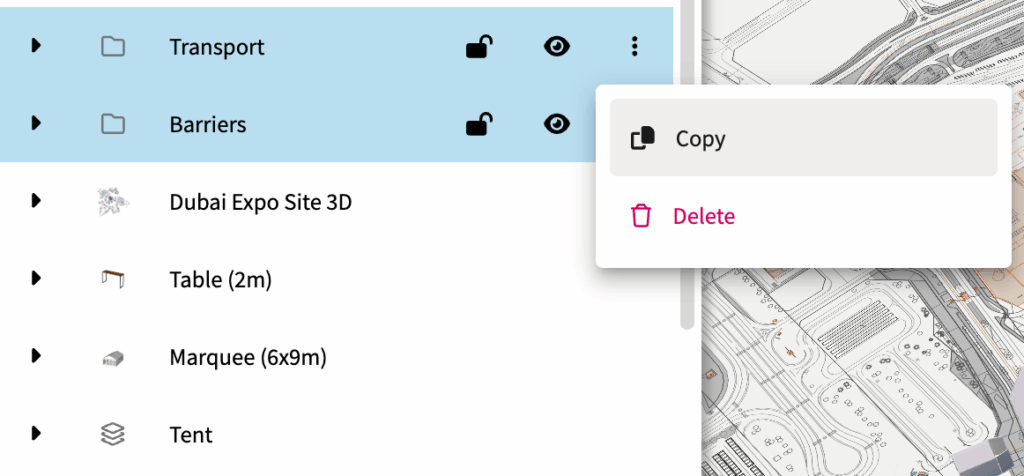
You can now group several groups of layers together, and easily copy an entire group.

You can now convert a route to a regular line. This is useful when you need to more more precise adjustments to a line, or move the line off the road network.
When working with a line of 3D models such as barriers or traffic cones, there is now an option to show a regular 2D line underneath. Because 3D models are often small, this means the lines can still be seen when zoomed out helping to visualise how they fit into the wider plan.
You can now lift 3D models off the ground by changing their altitude. This can be done for an entire layer (in layer settings) or for each object. This is useful for visualising signage, banners or stacking objects on top of each other.
Quickly capture and share your map view directly within Iventis — no external tools needed, without the toolbar in the way. Great for reports, presentations, and quick team updates.
When using the Digital Twin, a high resolution, rendered image is produced to show the 3D visual at it’s best.
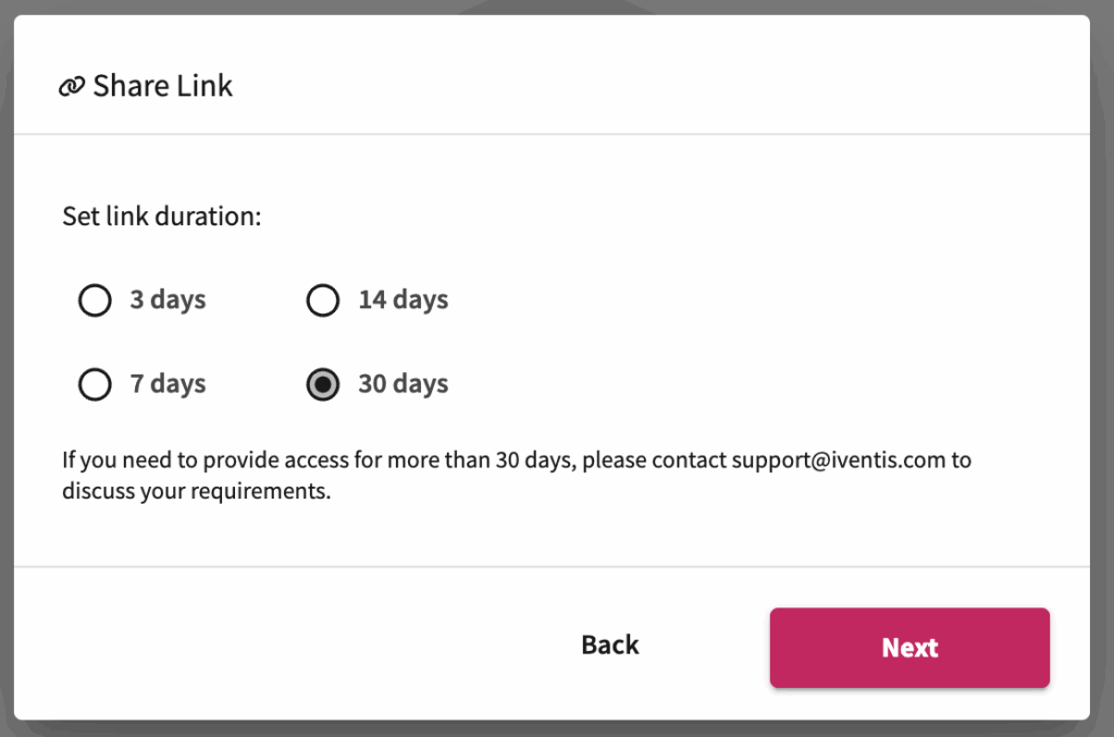
Now you can set custom expiry dates for shared links to control access and improve security.
It is now possible to rotate icons individually, as well as setting the overall rotation in the layer settings. Set the icon alignment to “North Aligned” to keep them a fixed orientation regardless of how the map itself is rotated.
Areas can now be filled with set numbers of 3D models, which can be used to visualise crowd densities or generate other models such as trees. The new layer type can be customised with random or uniform patterns, rotations and quantities.
Iventis can now support highly detailed terrain models from a variety of sources. These provide a high degree of topographical accuracy when planning. Iventis can provide data from different providers, or incorporate custom survey data. Speak to support for more info (support@iventis.com).
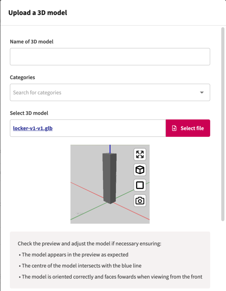
Uploading 3D models is now easier with a preview, check-list and thumbnail generator.
“Birmingham 2022 is the largest event to be held in the UK since London 2012. That means it is an incredibly complex operation for us to manage. Iventis allows us to knit all of those requirements together in a single platform. It’s absolutely fantastic and so useful across the supply chain for everybody to have access across all of the different venues and fantastic from an efficiency and commercial value perspective”

“The Iventis mapping software has been instrumental with plotting, measuring and storing the relay route on a secure platform. It allows relay planners to use the mapping software as a development tool, creating and amending the routes. Additionally, it allows for multiple user groups, with various access rights, to view or edit plans and see real-time route amendments. Plans can be shared via a link or exported in KML and PDFs files.”