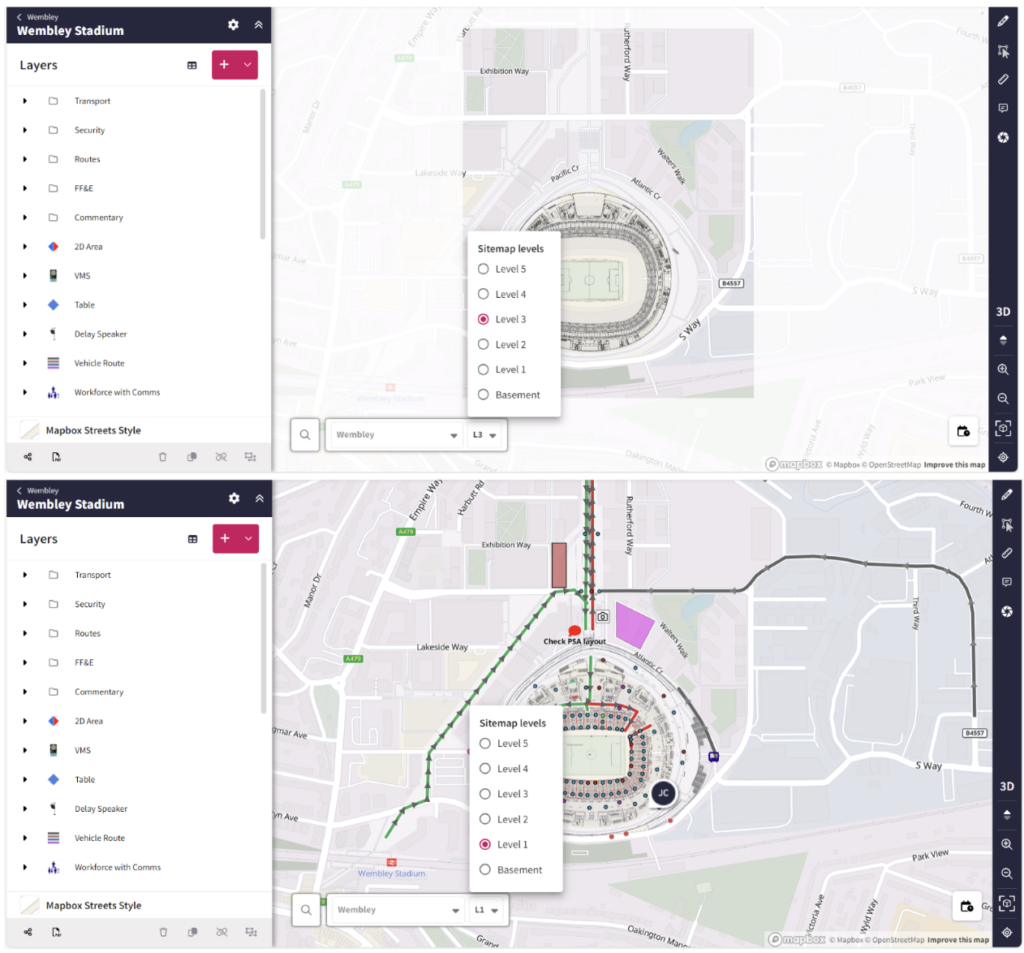
 Map objects are now attached to specific sitemap levels, and each level above ground features a frame that prevents users from drawing outside of these boundaries. This is so that users do not get confused between levels and draw on the wrong level, helping to reduce errors.
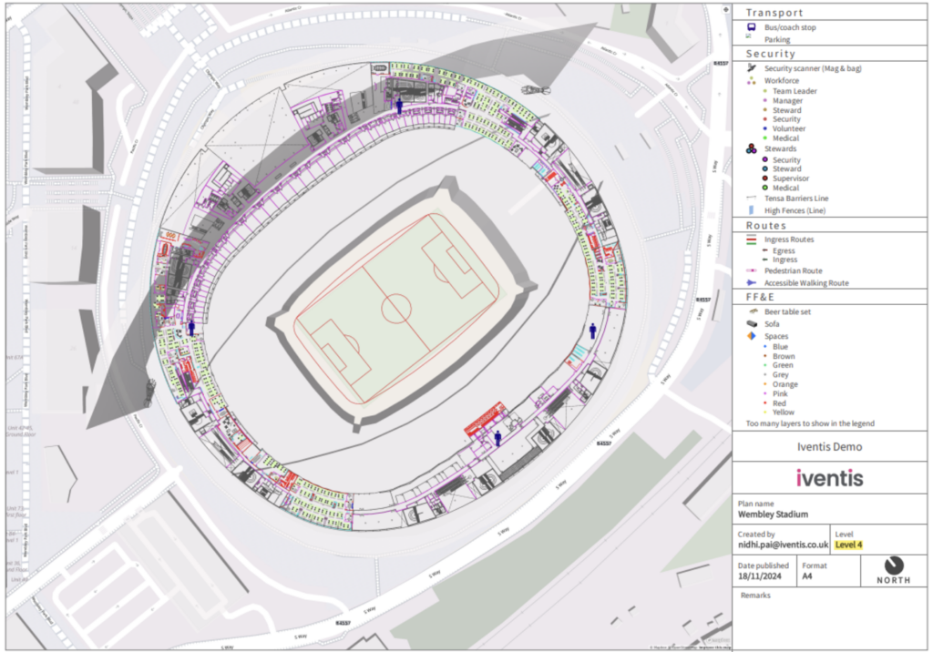 The legend of your PDF exports will now show which level is being displayed in the image. This helps differentiate the levels and add clarity for users working on large plans with multiple levels.
"Iventis helped us to provide a solution-led, end to end service for organisers of The Game Fair from CAD drawings and live operational planning to a visual sales tool that helped mark out the site on the ground."

“Birmingham 2022 is the largest event to be held in the UK since London 2012. That means it is an incredibly complex operation for us to manage. Iventis allows us to knit all of those requirements together in a single platform. It’s absolutely fantastic and so useful across the supply chain for everybody to have access across all of the different venues and fantastic from an efficiency and commercial value perspective”