Product Updates

January 2024

31st January 2024

Route Generator

New

Route Generator
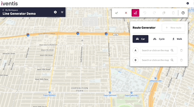
The new Route Generator tool auto-generates routes, helping users to reduce time and improve the accuracy of routes such as pedestrian and vehicle routes.
 

  • Automatic route generation: Set origin and destination points by searching or clicking on the map. The tool calculates the quickest routes for cars, bicycles, or pedestrians over any distance
  • Automatic waypoint generation: Waypoints are automatically created and saved to your Layers allowing you to create routes by defining key points of reference that can be used for location and navigation
  • Precision control: For greater control and more complex routes, add intermediate points or drag the route to tailor it exactly how you want it 
  • Edit anytime: Even after saving, come back anytime to make further adjustments  
31st January 2024

Add Custom Remarks to PDFs

New

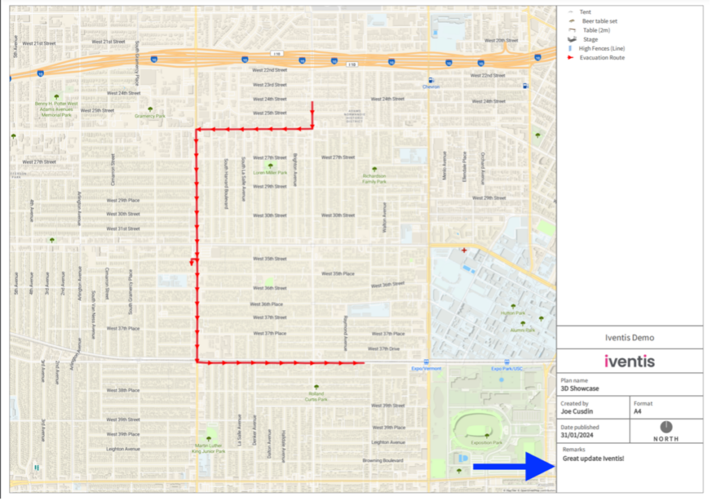
Users can add customised remarks to a PDF export for improved insights.  
 
This new feature allows users to add version information or other pertinent notes to PDF exports, which are displayed within the legend. 

31st January 2024

January 31 Improvements

Improved

Users can now: 

  • Experience a faster and more responsive map with our recent performance enhancements 
  • Use attributes to determine the spacing between models in 3D line layers, allowing for precise adjustments such as identifying the gap between barriers  

Issue fixes: 

  • Long names/emails will no longer overflow the “Created by” box in PDF outputs
  • Hidden layers and groups will no longer show in PDF legends 


15th January 2024

Precision Planning with What3words Integration

New


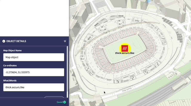
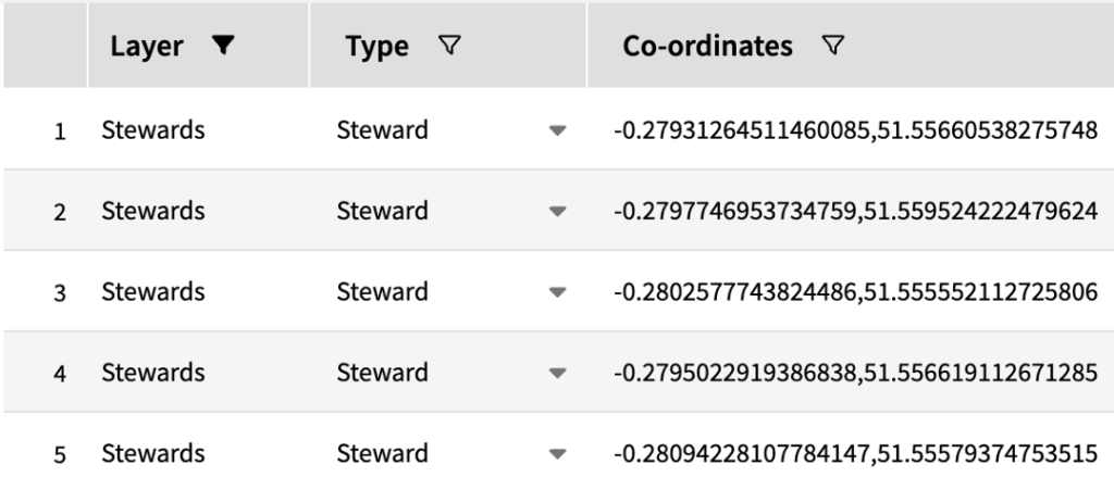
What3words is now integrated into the Iventis Planner as an attribute type.

With What3words, users can quickly pinpoint any 3 x 3 square in the world using a with a simple three-word phase. For instance, the central spot in Wembley stadium is represented by ‘years,spike.raced’. The integration provides users with the ability to:

  • Explain exactly where something is or should be, easier than relaying complex coordinates
  • Plan exact location information alongside other crucial data from directly within an Attribute table
  • Download What3Words data for multiple points

To see the feature in action, brought to life by Matthew from the Iventis Development Team, click here.

15th January 2024

GPX File Import Capability

New

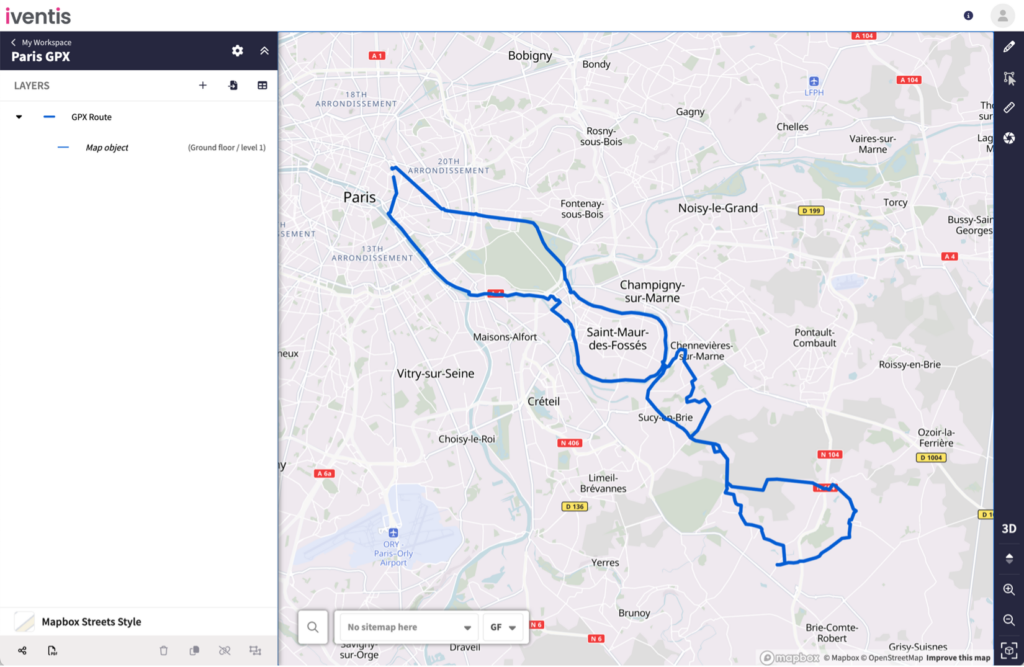
Iventis now supports the import of GPX files , a widely used format in GPS software. Satnavs and running/cycling apps like Strava offer the capability to export GPX data which traces a route.

This latest feature enables users to physically walk, drive or cycle a route, such as a marathon route, and import it directly into Iventis to help plan events.

14th January 2024

14 January 24 Improvements

Improved

Users can now:

  • Use the Delete shortcut key to delete Layers inside groups
  • More easily sort and view columns in an Attribute table

Issue fix:

  • When exporting list attributes with special characters


5th January 2024

Get Location Co-ordinates For Points, Icons and Models

New


Users can view, copy, or download coordinates (latitude and longitude) for any single-point map object, and access the coordinates for individual or multiple objects conveniently through the Attribute table.


5th January 2024

Time Attributes

New

Users can now capture times, or time ranges, as attributes.  Perfect for adding:

  • operating hours
  • shift patterns
  • and more time-related data

to your mapped objects.

5th January 2024

5 January 24 Improvements

Improved

Users can now:

  • Experience a clearer measurement display for a greater level of accuracy when measuring areas
  • Hover over long map object and folder names and view them in the sidebar


Trusted by the World's Best Since 2015

"Iventis helped us to provide a solution-led, end to end service for organisers of The Game Fair from CAD drawings and live operational planning to a visual sales tool that helped mark out the site on the ground."
Rupert Bassadone Founder, Event Site Design
“The Iventis mapping software has been instrumental with plotting, measuring and storing the relay route on a secure platform. It allows relay planners to use the mapping software as a development tool, creating and amending the routes. Additionally, it allows for multiple user groups, with various access rights, to view or edit plans and see real-time route amendments. Plans can be shared via a link or exported in KML and PDFs files.”
festival planning tool
Otto Kamenzin Torch Run Senior Manager
Agricultural Show Planning

Get started for free

Take a look around, pay and add your team later.

Start Free Trial Book a Demo