The year is well underway, and our team has been hard at work bringing exciting and helpful new features and improvements to the Iventis Planner. Read on to discover some of the key updates.
Explore the improvements from Oct-Dec 2023 here.
January 2024
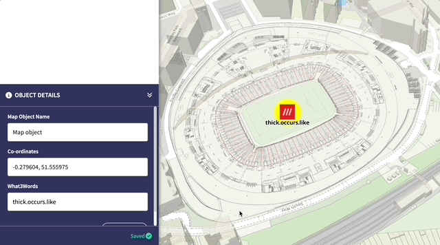
Precision Planning with What3words
This highly anticipated update enables users to locate any point on their plan using What3words as an attribute type. The 3x3m point is then represented by three unique words – for example, the centre of Wembley Stadium is found at ‘years.spike.raced’. This integration enables users to explain specific locations with pinpoint accuracy and plan exact location information alongside other crucial data from directly within the Attribute Table.
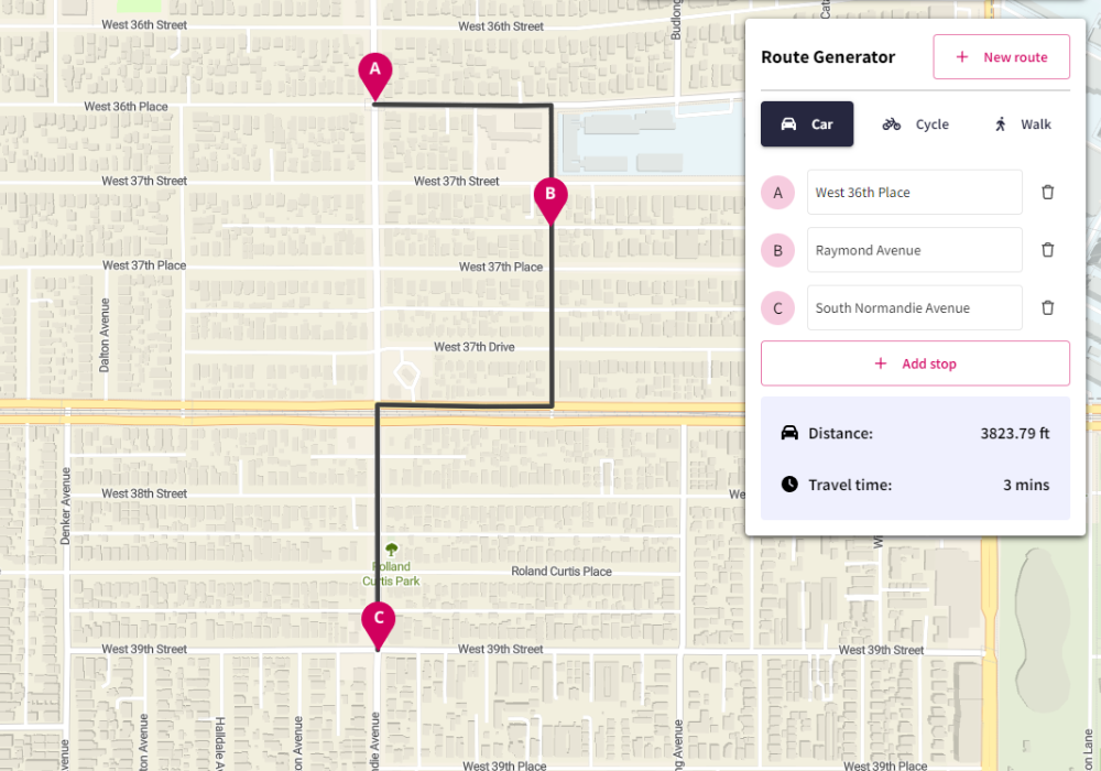
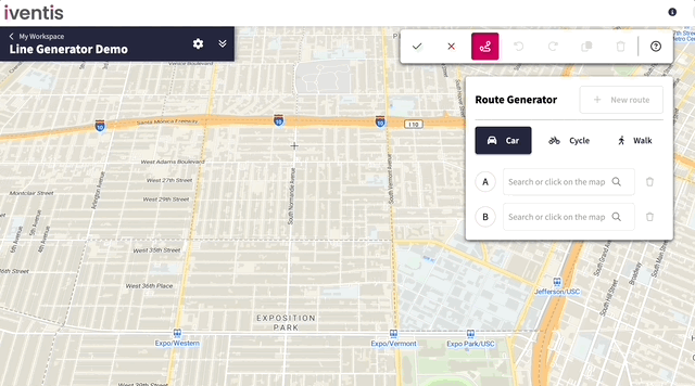
Route Generator
The new Route Generator tool automatically creates routes from one point to another, reducing time spent manually drawing routes and improving the accuracy of both pedestrian and vehicle routes. The feature calculates the quickest route over any distance, for cars, bicycles, or pedestrians, and automatically creates waypoints which are saved to your Layers. The routes can also be edited at any point, even after saving.
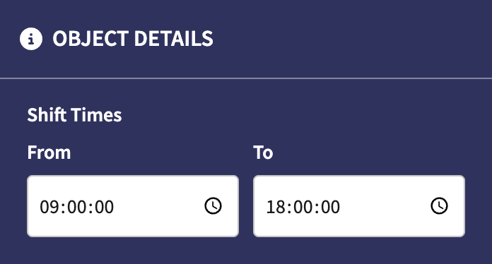
Time Attributes
Attributes are one of the most powerful features of the Iventis Planner, enabling users to capture all the intricate details needed to orchestrate even the most complex events. Now, users can capture times, or time ranges, in their layer attributes, providing a further level of detail. This new feature is especially useful for adding operating hours, shift patterns, and other time-related data.
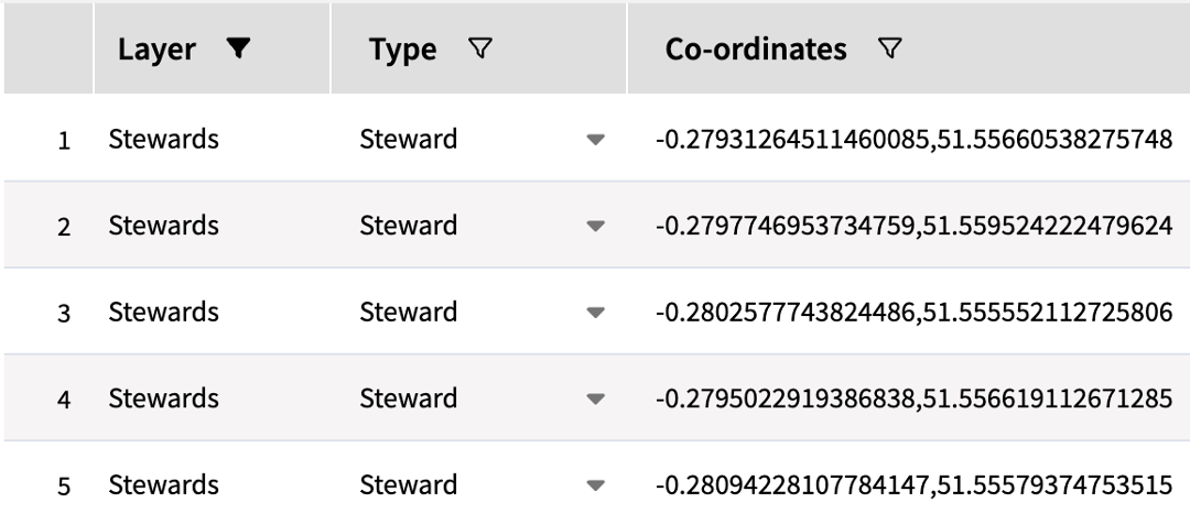
Location Coordinates
Plotting single-point map objects is now more accurate than ever. Users can view, copy and download an object’s coordinates through the Attribute Table. The latitude and longitude are accessible for any single-point map object, including points, icons and models, and can be accessed across individual or multiple objects.
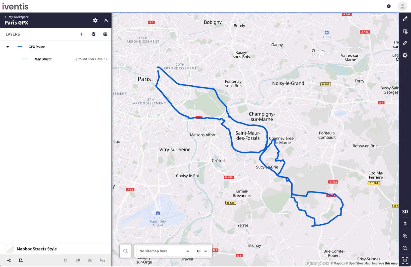
GPX File Import
GPX files are a widely used format in spatial GPS software, frequently used in Satnavs and running/cycling apps. In this use case, users are able to export GPX data which traces a route.
Now, users can physically walk, cycle or drive along a route and directly import it into the Iventis Planner. This is particularly useful for racing events such as a marathon or triathlon.
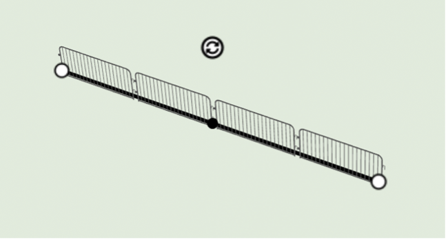
Spacing in 3D Line Layers
3D line layers are incredibly useful for plotting repeated items, such as barriers, fencing or Portaloos, without having to individually plot each model. Users can now determine the spacing between models in 3D line layers by using attributes, allowing for precise adjustments to the gaps between items.
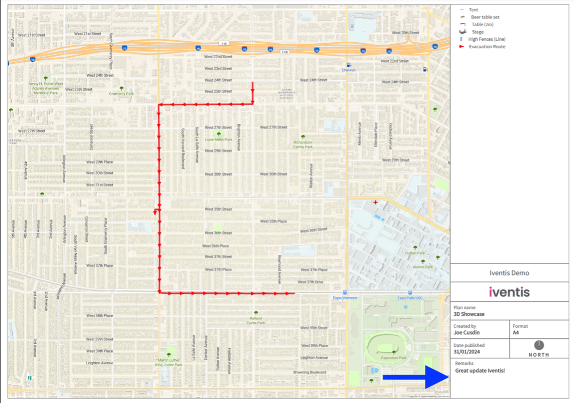
Custom Remarks on PDFs
Iventis plans are easily shared via PDF, showing the static map alongside information such as the date, name and legend. Now, PDF sharing offers users the ability to add remarks to the document. This allows users to easily share updates, version information, or any other important notes directly to the PDF export file.
Additional updates
- Measurement display is clearer for greater level of accuracy when measuring areas
- Users can now hover over long map object or folder names to view them in the side bar
- The Delete shortcut key now allows users to delete Layers inside groups
- Sorting and viewing columns in the Attribute Table is easier
- Performance enhancements provide a faster, more responsive map experience
- Attributes with special characters now export correctly
- Long names and emails no longer overflow the “Created by” box in PDF outputs
- Hidden layers and groups no longer show in PDF legends
February 2024
3D Line Layer Offsetting
Our 3D Line layer functionality is one of our most popular drawing tools, so we’ve enhanced the feature to improve the accuracy of drawing a line of 3D models. Now, when drawing, the starting point can be offset to align with the start of the line.
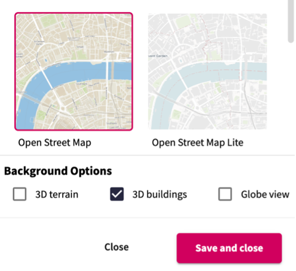
3D Buildings Toggle
The ability to view 3D buildings on a background map can be valuable when planning events, especially when understanding viewpoints, height restrictions and existing infrastructure. 3D buildings can now be toggled on or off within any background map to improve the planning experience.
KML and KMZ File Imports
KML and KMZ file formats are commonly associated with Google Maps products, and this new capability enables Google Earth data to be imported directly into the Iventis Planner. This allows users to import KML and KMZ data themselves and use it within their plans.
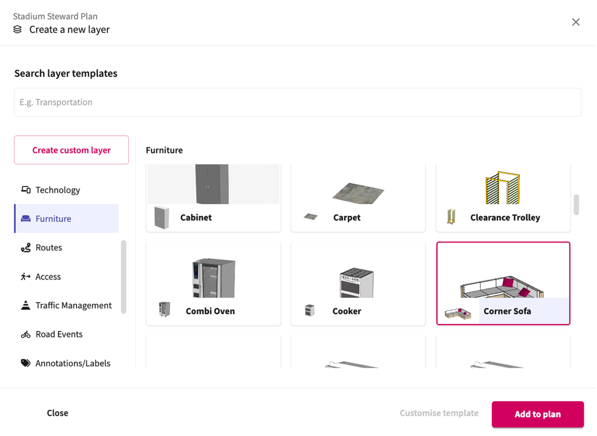
Improved Layer Template Gallery Categorisation
The template gallery contains a comprehensive library of layer templates for users to select from and add to their plans. We have enhanced the template gallery layout to make it easier for users to find what they’re looking for. The layers are now categorised on the side of the panel, with easy-to-use groupings such as ‘Technology’, ‘Furniture’ and ‘Routes’. Plus, users can now create their own custom layers if they need something more bespoke that isn’t currently available.
Hyperlinks to Map Objects
Users can now easily attach web links to map objects such as points, icons and models. The links might be to a website or to a document which, upon clicking, will open in a new browser tab. The new feature operates as a new attribute for the map object and can also be accessed from the Attribute Table.

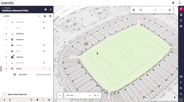
Image Attributes on Map Objects
Photos and images can now be uploaded to a map object as an attribute. This feature helps users to provide additional detail such as perspective from different seating tiers, pinpoint venue vulnerabilities, or further demonstrate the layout of the plan.
Additional updates
- In PDF legends, a line now displays at the bottom of each group to indicate the layers contained within
- Improved experience when importing large quantities of layers
- Users can now import all layers from one plan into another, maintaining groupings
- When importing an entire group of layers, the group itself is also imported, and users can copy groups within their plans
- Multiple site maps (CADs) no longer appear in the same location during PDF exports
- Rectangular shape sizes now update in accordance with their attributes
That’s all for the first two months of 2024, but our team are hard at work to bring more improvements to the Iventis Planner all the time. If you have a specific feature in mind that you think could enhance your experience, why not get in touch to let us know?