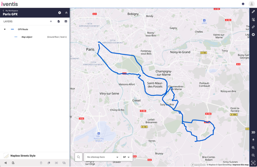
Iventis now supports the import of GPX files , a widely used format in GPS software. Satnavs and running/cycling apps like Strava offer the capability to export GPX data which traces a route.
This latest feature enables users to physically walk, drive or cycle a route, such as a marathon route, and import it directly into Iventis to help plan events.
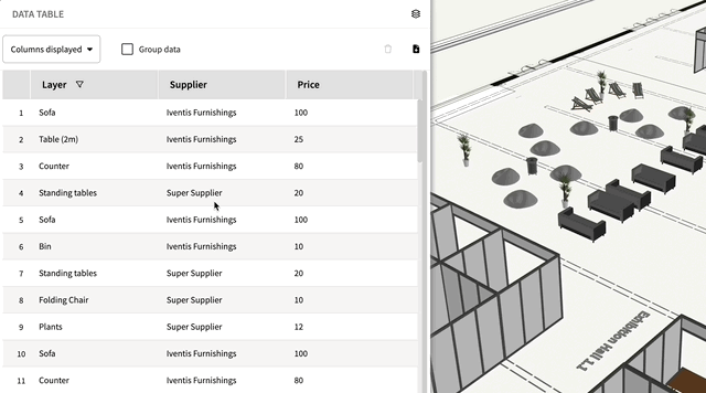
Users can now group data in an attribute table, either by layer or attribute, to instantly see total quantities, costs, or any other specifics. This advanced feature also allows users to group data by more than one level, such as by both venue and layer.
Grouping attribute data makes it easier for planners to keep track of total resources and be able to monitor budgets in real-time. To watch a short explainer video of how to use this feature, click here.
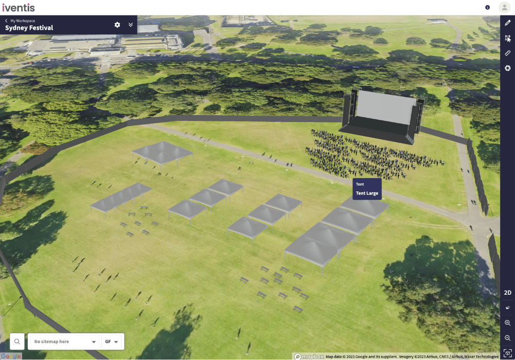
Users can now access the latest global satellite and aerial imagery from Google! Google provides one of the most extensive and detailed sets of imagery across the world.
This latest addition complements the existing collection of imagery providers, enabling users to select the most suitable background for their location.
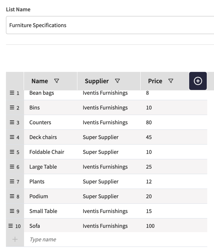
This new feature provides users with the capability to expand attribute lists with additional columns. For example, a furniture list can now be extended to include suppliers, colours, and prices for each item. This unlocks powerful new analysis opportunities, helping users to closely monitor quantities and costs.
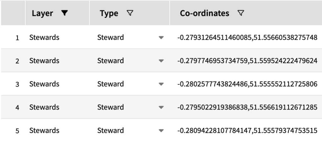
List attributes allow users to select from a list when adding objects to a plan such as a venue, type of equipment, role, or anything else.
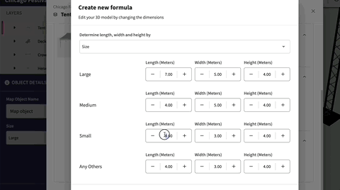
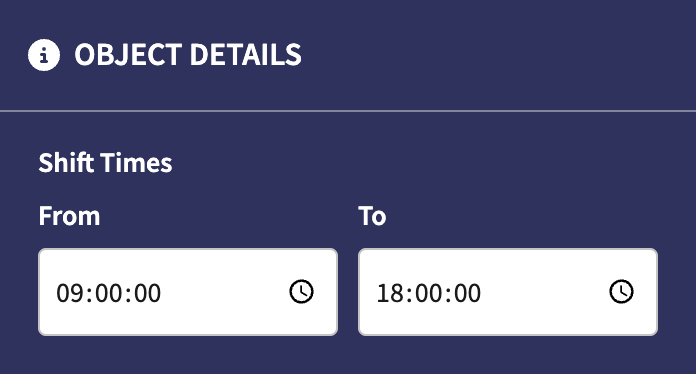
This new 3D planning feature allows users to dynamically and precisely resize 3D models. Users can edit the size of:
to plan more accurately. Attributes can also be used to set the type and size of 3D objects.
“The Iventis mapping software has been instrumental with plotting, measuring and storing the relay route on a secure platform. It allows relay planners to use the mapping software as a development tool, creating and amending the routes. Additionally, it allows for multiple user groups, with various access rights, to view or edit plans and see real-time route amendments. Plans can be shared via a link or exported in KML and PDFs files.”

“We were happy to team up with such a renowned company as Iventis which significantly supported our team in their planning and delivery. The system was used across several functional areas to develop plans and co-ordinate our efforts in the run up to the event.”