Users can now:
Issue fixes:
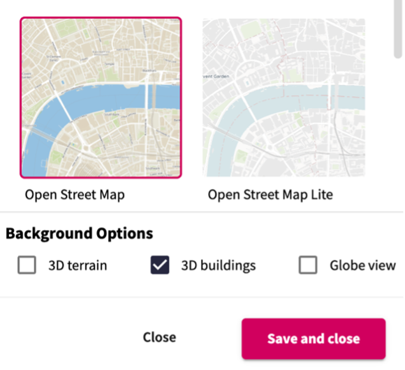
Users now have the option to toggle 3D buildings on or off within a background map.
Users can now import all layers from one plan into another. This helps to bring plans together for reviewing or analysing.
Additionally, when importing an entire group of layers, the group itself is now also imported, and users can also copy groups within plans.
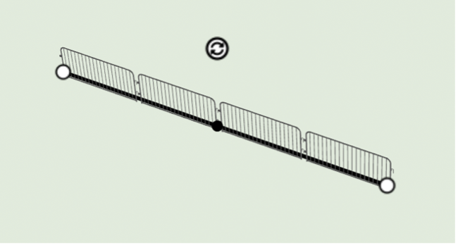
When drawing a line of 3D models, the model starting point can be offset to align with the start of the line.
This helps to improve the accuracy of drawing certain layers – like barriers and fencing.
Users can now:
Issue fixes:
Users can now:
Issue fixes:
Users can now:
Issue fix:
Users can now:
Users can now:
Users can now:
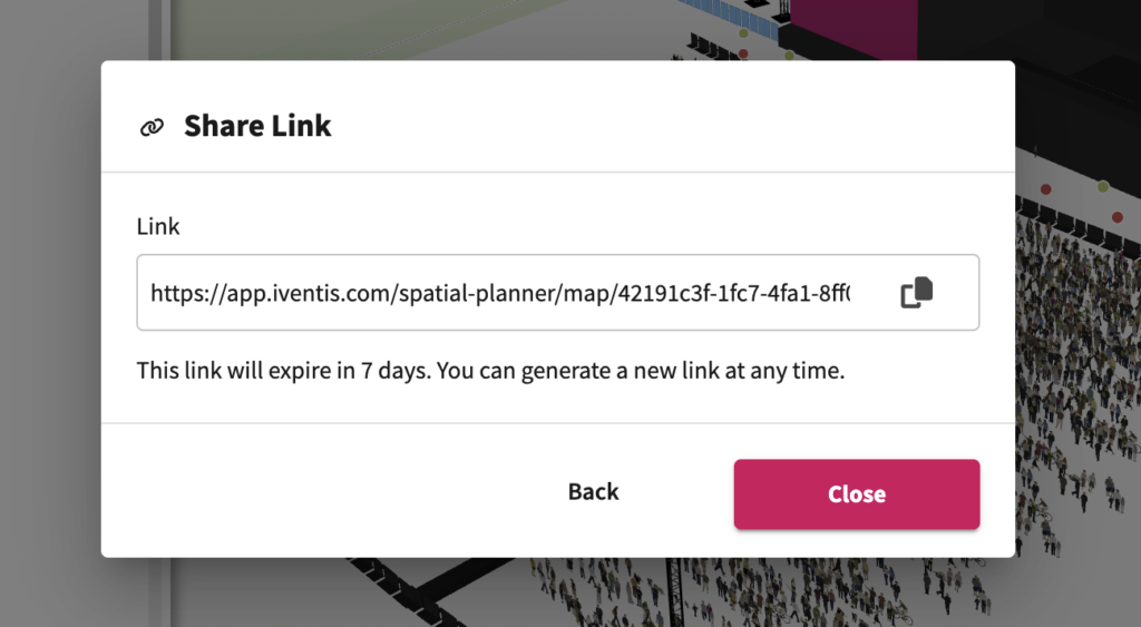
Users can now share a link to a particular plan with non-Iventis users, speeding up the process of sharing plans with team members, suppliers, and partners.
Users can now:
“Birmingham 2022 is the largest event to be held in the UK since London 2012. That means it is an incredibly complex operation for us to manage. Iventis allows us to knit all of those requirements together in a single platform. It’s absolutely fantastic and so useful across the supply chain for everybody to have access across all of the different venues and fantastic from an efficiency and commercial value perspective”

“We were happy to team up with such a renowned company as Iventis which significantly supported our team in their planning and delivery. The system was used across several functional areas to develop plans and co-ordinate our efforts in the run up to the event.”