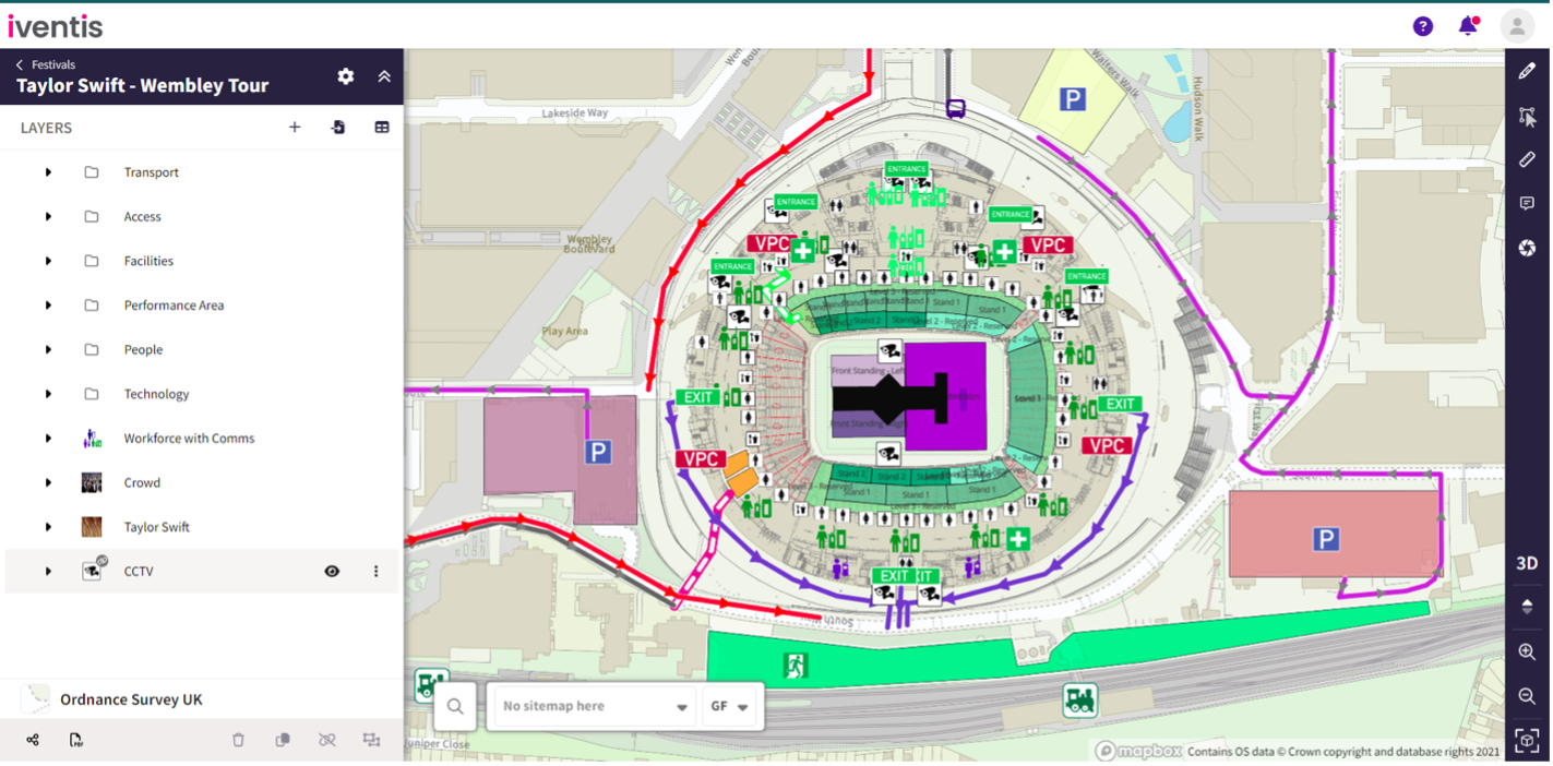
External users viewing a plan via a shared link can now view imported layers.
Enhanced Support for Non-English Characters
The Iventis Planner now seamlessly supports project names with non-English characters, including accents, diacritics, and symbols.
Faster Map Loading Speed
Maps now load quicker, enhancing performance when drafting, exporting, drawing, and editing plans.
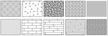
A fill pattern can now be viewed in your AutoCAD drawing to represent hatching for different layers and objects. These will be imported from your original CAD plan and be integrated into Iventis when we upload your file.
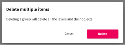
Confirmation when deleting a group
A new confirmation prompt now appears when you try to delete a layer from a selected group. This will help you to avoid deleting multiple important layers and objects!
Issues fixes:
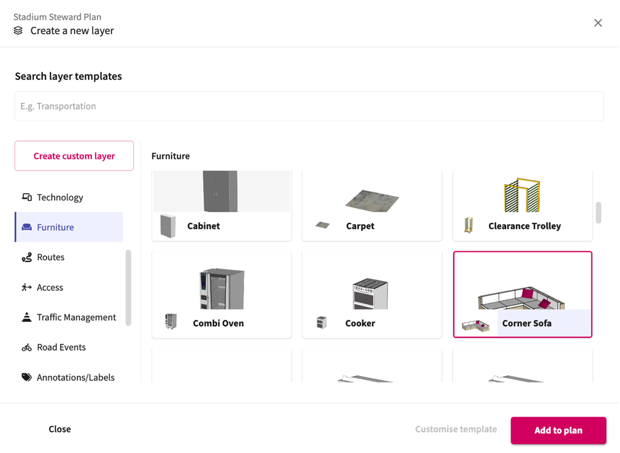
Our extensive template gallery has been enhanced to provide improved categorisation, making it easier for users to explore or search.
Additionally, users now have the option to create their own custom layers if they are unable to find a suitable template.
Users can now:
Issue fixes:
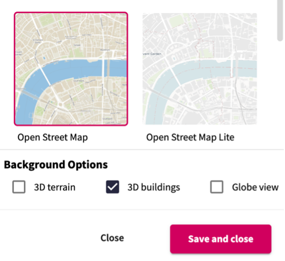
Users now have the option to toggle 3D buildings on or off within a background map.
Users can now import all layers from one plan into another. This helps to bring plans together for reviewing or analysing.
Additionally, when importing an entire group of layers, the group itself is now also imported, and users can also copy groups within plans.
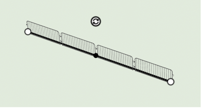
When drawing a line of 3D models, the model starting point can be offset to align with the start of the line.
This helps to improve the accuracy of drawing certain layers – like barriers and fencing.
Users can now:
Issue fixes:
Users can now:
Issue fixes:
“We were happy to team up with such a renowned company as Iventis which significantly supported our team in their planning and delivery. The system was used across several functional areas to develop plans and co-ordinate our efforts in the run up to the event.”

“The Iventis mapping software has been instrumental with plotting, measuring and storing the relay route on a secure platform. It allows relay planners to use the mapping software as a development tool, creating and amending the routes. Additionally, it allows for multiple user groups, with various access rights, to view or edit plans and see real-time route amendments. Plans can be shared via a link or exported in KML and PDFs files.”