
The COP26 United Nations Climate Change Conference, held in 2021 in Glasgow, was one of the largest summits ever held in the UK. Bringing together 140 World Leaders, 25,000 conference delegates, climate experts and campaigners, alongside the world’s media. COP26 required robust, complex and collaborative organisation.
Major summits like COP26 require months of intricate planning due to the complex operational impact they have on their host cities. In the case of COP26, the requirements were even more stringent. Operations had to be led by sustainability given the event was focused on the climate change crisis. For Transport Scotland, this meant finding a way to ensure safe and sustainable travel within and around the event.
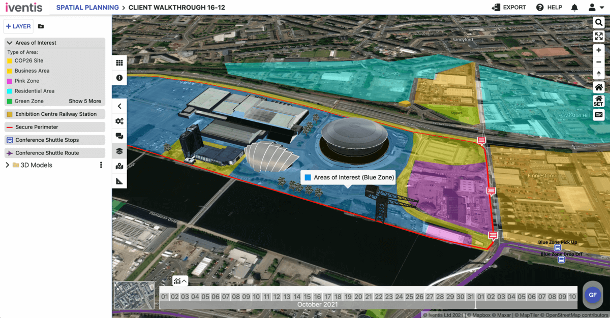
The event spanned farther than the Scottish Event Campus (SEC) primary venue. It impacted operations across Glasgow and beyond. Planning aspects such as security, transport and city operations in spaces outside of the core ‘blue zone’ were particularly complex and challenging.
Global summits involve a myriad of stakeholders, beyond the event organisers – agencies such as transport authorities, local government, police, and other services are all involved and responsible for meticulously planning the operations of their specific functional area.
Transport Scotland were understandably eager for visitors to use public and sustainable modes. of transport, but with 40,000+ people it required additional services to provide adequate transport within Glasgow and to key locations such as the airport.
The Iventis Planner was designed to support both the planning and operational phases of large-scale events such as COP26. With Iventis, Transport Scotland were able to have one comprehensive planning tool that encompassed the combined emphasis on efficiency, sustainability and safety that the event required.
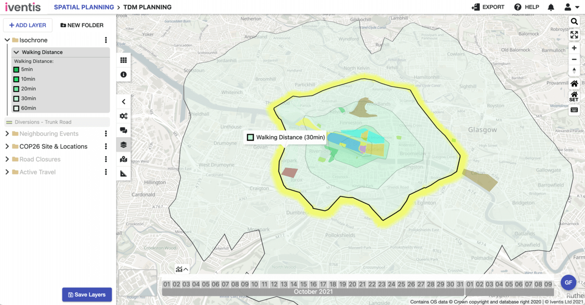
Planners were able to use Iventis to plot the location of hotels and accommodation across the city to ensure there was adequate transport provision, and cycling and walking were encouraged and walking times to the venue calculated.
Road closures, diversions, and checkpoints for security and demand management purposes were aplenty. With Iventis, planners were able overlay the location of closures and traffic modelling data to understand the impact on their plans.
Operational capacity
Through the Planner, Transport Scotland was able to identify areas where current operations would not be sufficient. With this knowledge, it could implement overflow parameters, such as more public transport vehicles and greater police presence.
With so many stakeholder agencies and delivery partners involved across Glasgow and neighbouring areas, it was essential for a clear and shared understanding of all plans. Scenarios were tested through desktop exercises, brought to life through interactive plans, which enabled robust scenario preparation for all.
“With so many partners involved and the vast amount of information for COP26, Iventis enabled the team to bring together all plans in an easy to use, efficient and effective manner helping deliver a successful event.”
David Laing, Events Resilience Manager, Transport Scotland
Iventis’ capacity to support rapid and real-time planning combined with its collaboration functionality significantly contributed to the operational success of COP26, demonstrating the importance of adopting technology solutions that facilitate complex planning requirements. Whether for security, transportation, or other operational areas, a visual planning platform like Iventis offers a competitive advantage and improves the planning efficiency and execution of major summits.
To find out more about how Iventis can help streamline your operational planning, speak to one of our experts today.
“The Iventis mapping software has been instrumental with plotting, measuring and storing the relay route on a secure platform. It allows relay planners to use the mapping software as a development tool, creating and amending the routes. Additionally, it allows for multiple user groups, with various access rights, to view or edit plans and see real-time route amendments. Plans can be shared via a link or exported in KML and PDFs files.”

“We were happy to team up with such a renowned company as Iventis which significantly supported our team in their planning and delivery. The system was used across several functional areas to develop plans and co-ordinate our efforts in the run up to the event.”